

Rotterdam
The construction of a rain radar has started on the roof of one of the highest building in Rotterdam city centre. The radar will make it possible to measure precipitation patterns in the city much more accurately and, as such, facilitate improvements in the quality and efficiency of the city’s water management. Possible applications for the data include the intelligent control of pumping stations, the use of water storage (such as the water squares) and local weather reports.
Introduction Rotterdam Case Study
Rotterdam City is lying in the Western part of the Netherlands, on the borders of the river Rhine delta (fig. 1). The western part of the city, nearest to the North Sea covers one of the largest port areas in Europe. With about 600,000 inhabitants Rotterdam is the second largest city in the Netherlands. The city area contains 30 km of port area and 400 km of canals.
Most of the urban area is built in polders with ground levels down to 7 meters below sea level. The City of Rotterdam recently developed a “Water vision 2030” that describes how the city plans to enhance its attractiveness as a water city, meanwhile protecting itself from the dangers of water, mainly floods. Three types of flooding threaten the city of Rotterdam: tidal surges from the North Sea, river floods on the river Rhine and pluvial floods in the densely built urban areas. All are expected to increase with climate change presenting a serious challenge to the protection of the city.
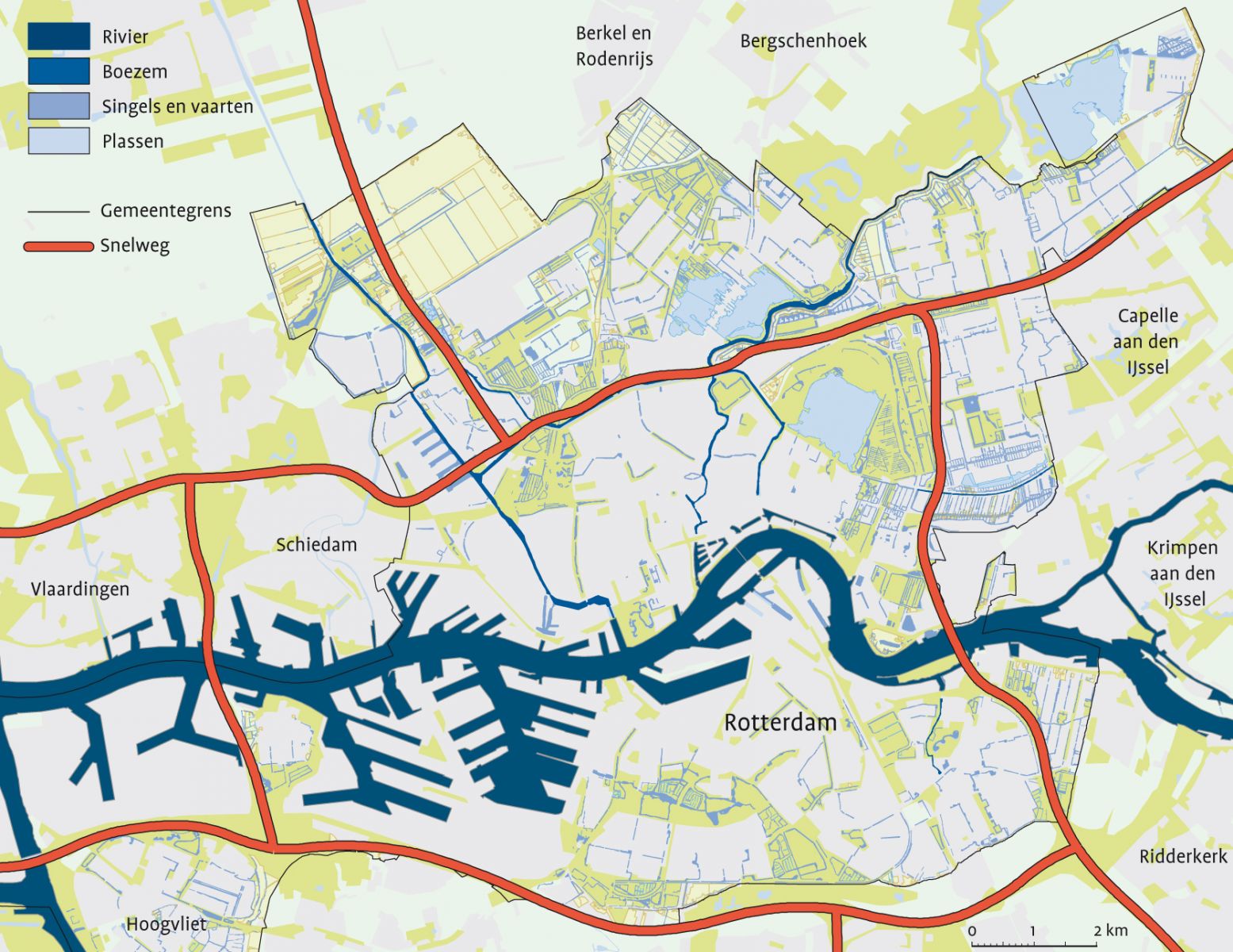 |
| Fig. 1: New Waterway river flowing through the City of Rotterdam to the North Sea; urban area of Rotterdam north and south of the river and port areas towards the North Sea. Municipal borders of Rotterdam indicated in yellow |
Currently, rainfall in the Rotterdam area is collected in ponds, canals and am extensive underground pipe network through which rainwater is transported to pumping stations that pump the water out to the New Waterway river. Since almost all of Rotterdam lies below sea level, the only way to evacuate excess rainwater is through pumping stations. In the current situation, urban flooding occurs at regular intervals (up to several times per year) and additional water storage is urgently needed to reduce damage from flooding. This situation will worsen with expected results of climate change, as sea and river levels rise by a meter or more and rainfall events become more heavy intense. It is estimated that 80 hectares of lakes and canals must be created to cope with excess rainwater in the city area. This space is unavailable in the densely built urban areas and alternative solutions must be found to protect the city from increased flooding. Detailed rainfall and flood data are a first requirement to be able to develop such solutions. Therefore, an X-band radar will be installed in the city centre of Rotterdam. Data from this radar will be combined with data from a series of rain gauges in the city and the C-band radar that is owned by the Royal Dutch Meteorological institute to obtain accurate and detailed rainfall estimates and to develop rainfall forecasts. Test cases will be selected for detailed modelling of flooding that results from heavy rainfall events. Based on this information, effective solutions for improved flood protection will be developed.
Rotterdam Water City 2030 and international cooperation projects
The city of Rotterdam is developing plans and project to realise the Water City 2030 Vision. Two important projects in this context are the national “Knowledge for Climate Research program“ in which Rotterdam is designated one of the hotspots for research and the European SWITCH project. In this project innovative solutions for flood water management are developed, like water squares and super levees. Rotterdam is also involved SMARTeST, an EU-FP7 project that aims to develop smart solutions for flood resilience. The city’s involvement in these projects provides a fertile environment for development and application of innovative flood protection technologies.